
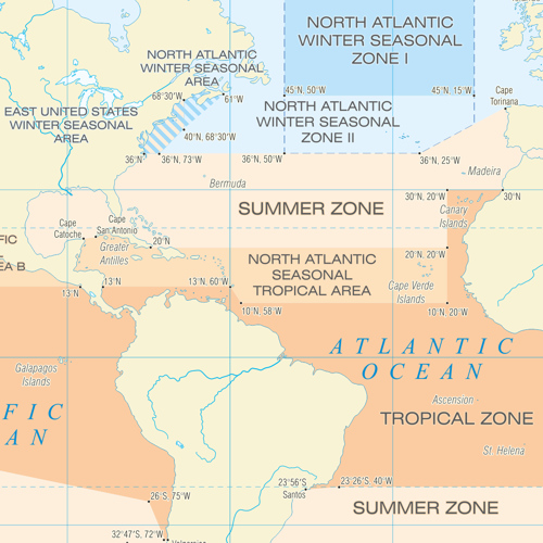

A comprehensive, colour-coded world map summarising data from the 1966 International Convention on Load Lines and Protocol of 1988, together with the 2003 and 2014 amendments.
The International Load Line Zones and Areas map outlines Summer, Winter and Tropical Zones, Seasonal Areas as well as their Fresh Water equivalents.
Also listed are the co-ordinates of the outer limits. Applicable dates are shown below the map, together with a schematic of standard load line markings and abbreviations.
International Load Line Zones and Areas Map
SKU: SGLILLZAAM
$90.00Price
16th Edition
Size A3, encapsulated (double sided plastic protective layer to seal in the map - waterproof)